


Perihal Austrian Map mobile
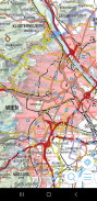
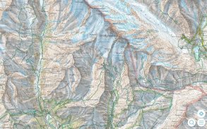
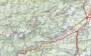
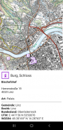
The Austrian Map mobile (AMap mobile) contains the digital maps of Austria including hill shading, geographic names database “Geonam” and the digital elevation model. This digital product of the Bundesamt für Eich- und Vermessungswesen (BEV) offers high quality topographic maps and a user-friendly interface with extensive functionality.
Maps and data available in the Austrian Map mobile:
* Overview Map 1:1 Million (free of charge)
* Cartographic model 1:500 000 (free of charge)
* Cartographic model 1:250 000
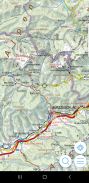
* Cartographic model 1:50 000
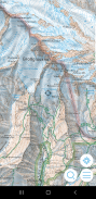
The app contains a map tile contingent of 550 tiles, which corresponds to 550 km ² in the scale 1:50 000 (no specific area, maps free to choose). This allows to test the capabilities of the AMap mobile in a specific area. Additional areas may be downloaded at will.
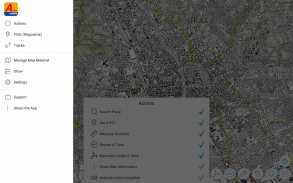
Functions of Austrian Map mobile:
* Search by toponym or search by coordinates
* GPS features: Display of the location, "moving map", compass support, routing along tracks
* Insert, edit and share POIs (Points of Interest)
* Recording and exporting tracks (tracks can be imported into AMap Fly)
* meta data about the used map sheets
Peta bimbit Austria (AMap mudah alih) mengandungi peta-peta digital Austria termasuk teduhan bukit, nama geografi pangkalan data "Geonam" dan model ketinggian berdigit. Produk digital daripada Bundesamt für Eich- und Vermessungswesen (Bev) menawarkan peta topografi berkualiti tinggi dan antara muka mesra pengguna dengan fungsi yang banyak.
Peta dan data yang terdapat di Austria Peta bimbit:
* Gambaran Keseluruhan Peta 1: 1 Juta (percuma)
* Model Kartografi 1: 500 000 (percuma)
* Model Kartografi 1: 250 000
* Model Kartografi 01:50 000
Aplikasi ini mengandungi kontinjen peta jubin 550 jubin, yang sepadan dengan 550 km² di 01:50 000 skala (tidak ada kawasan tertentu, peta bebas untuk memilih). Ini membolehkan untuk menguji keupayaan mudah alih AMap di kawasan tertentu. Kawasan tambahan boleh dimuat turun di akan.
Fungsi Peta Austria mudah alih:
* Cari mengikut Toponim atau carian mengikut koordinat
* GPS ciri: Mempamerkan lokasi, 'peta bergerak ", sokongan kompas, laluan di sepanjang trek
* Insert, mengedit dan POI saham (Tempat Menarik)
* Rakaman dan mengeksport trek (trek boleh diimport ke dalam AMap Fly)
* Meta data tentang lembaran peta digunakan
Austrian Map mobile - Versi 2.1.3
(20-10-2022)Austrian Map mobile - Maklumat APK
Versi APK: 2.1.3Pakej: com.garzotto.ammaAplikasi dalam kategori sama
Anda juga mungkin suka...


